Enhancing construction planning with Lidar scanning and PIX4Dcloud advanced
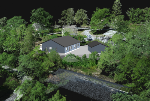
In a recent project, we used lidar scanning technology to survey an area slated for development as part of a property subdivision project. This innovative approach combines lidar data with IFC models of the proposed buildings and constructed surface layers aligned with the scanned terrain. The result is a highly detailed and accurate representation of the site, which facilitates seamless collaboration among stakeholders.
By integrating these datasets, we created a comprehensive visualization that provides critical insights into the topography and proposed construction plans. This data was subsequently uploaded to PIX4Dcloud Advanced, a platform that allows stakeholders, including the client, municipal authorities, and construction contractors to access and interact with the visualization.
The use of PIX4Dcloud Advanced ensures that all parties involved can review, analyze, and provide input on the project in real-time, enhancing decision-making and reducing potential misunderstandings. This approach not only streamlines the planning and approval processes but also demonstrates the value of combining cutting-edge technologies for smarter construction management.
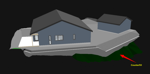
Additionally, we constructed an IFC file that simulated a backfill against the retaining wall to reduce its visible height. This strategic adjustment not only improves the aesthetic integration of the wall into the surrounding landscape, but also contributes to more efficient use of materials and overall structural harmony.
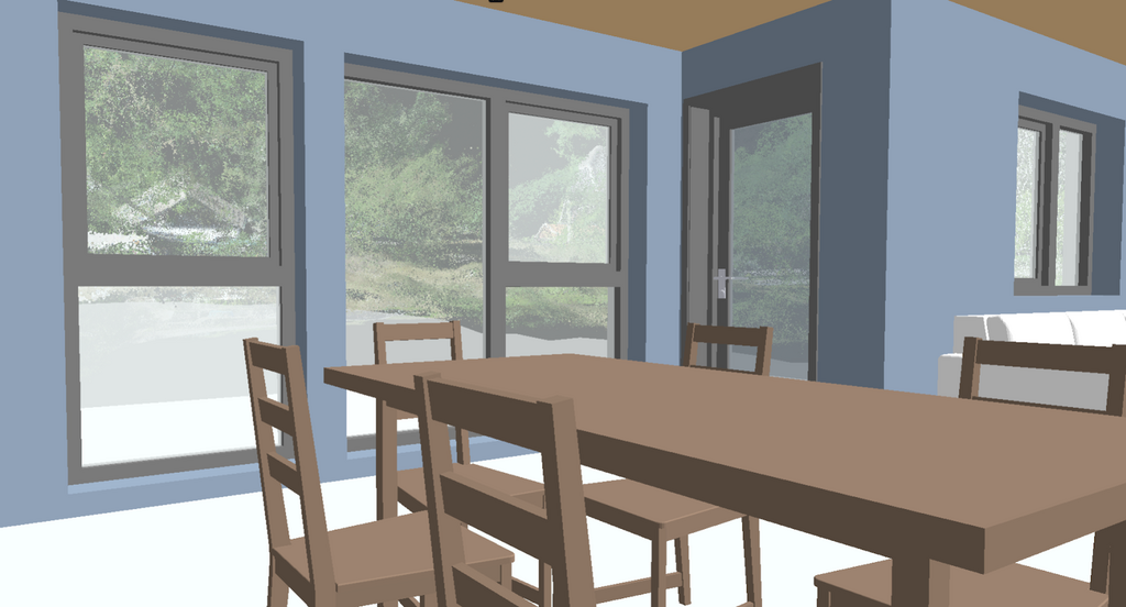
You can also enter the IFC model and view the point cloud from the lidar scan through the windows in the IFC model.
This IFC model can also be imported into Pix4Dcatch, so that the building can be visualized on site before construction begins. This helps ensure that the design and location of the building match expectations. The system is also an excellent tool for sharing information and conducting meetings with nearby stakeholders affected by the project.
We will publish more articles on the use of Pix4Dcatch on construction sites, as well as combining data from this system with data collected from other sensors.

"Written by Jørn Roger Johansen"